Carlson – CAP50

$13,900.00

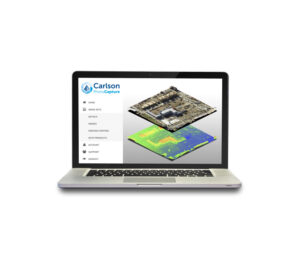
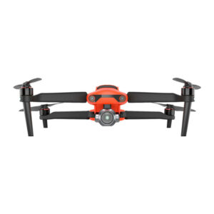
The new American Made CAP50 UAV is ideally suited for Land Surveying, Construction, Engineering, Mining, Quarry and Mapping applications. With a payload capacity of up to 6lbs it offers multiple payload options for Photogrammetry, LiDAR, and Bathymetry.

Key Features
• Payload capacity up to 6lbs
• RTK for accuracy
• Tested in 50mph winds with max payload
• Omnidirectional collision avoidance
• 22-minute flight time with 5lbs payload
• Compactible design for easy transport
• Full telemetry flightlog 

Object Avoidance
The CAP50 has 360 degree collision avoidance. The collision avoidance system is LiDAR range finder based, and will work in day or nighttime conditions. 

 Payload Configuration Options:

  • LiDAR (with or without imaging)
  • Photographic (42MP / 61MP) 35mm lens and gimbal
  • EchoLogger depth sounder 

The CAP50 includes the following ports for communication and control of payloads: 2xHDMI, 24V power, SBUS, Serial, PWM.

Downloads

Recommended Software Solutions

Aerial surveying and drone photogrammetry is rapidly becoming a vital part of any surveyor’s toolkit. Thousands of people use drone site flyovers every day to help boost efficiency and lower costs. With Carlson PhotoCapture drone photo processing software, you can use flyover data to: Quickly generate interactive 3D maps of sites Capture highly accurate 3D site data from any camera Share site maps with customers – anywhere, anytime! Save man-hours in the field Our proprietary technology helps you track and share every metric about your site from anywhere in the world. PhotoCapture is available both as a cloud-based service and as a standalone desktop application.

A modular program that provides the ability to go from field scan to finished plat, Carlson Point Cloud delivers powerful automation for large data sets. View and process up to 1 billion points all with Carlson ease-of-use.

  • Register scans to local coordinates, filter or decimate the points, and overlay raster images in 3D
  • Snap to edges and code descriptions for automated field-to-finish processing of linework and symbols
  • Create contours, profiles, sections, and breaklines from within the point cloud

Lastly, all surface models, points, contours, breaklines, grid and profiles can be exported to CAD.

Video